Cartography - Afghan Pamir Trekking Route Survey
Cartography, Map Design
2020 onwards
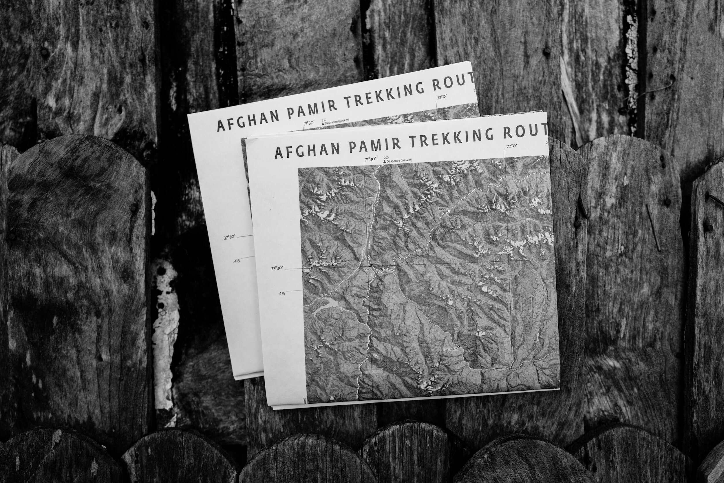
Inspired by, and in collaboration with expeditions organised by Studio D to the majestic Afghan Pamir, this project aims to create maps encouraging sustainable trekking, bikepacking, and adventure tourism in this remote corner of Afghanistan.
A work-in-progress v0.51d version of a 1:450,000 scale overview map of the Wakhan Corridor was printed by Studio D’s imprint Field Institute in 2021: a limited edition to garner expert feedback and corrections.
Data for this area is not comprehensively available from OpenStreetMap, Google, or other common repositories, so the data for this project has been collated and synthesised from sources including GPX data gathered in-field, local sources, satellite imagery, and various travel accounts and old maps found in obscure corners of libraries and the internet.
Collaborators: Adab Shah Gouhari, Jan Chipchase, Sam Kellogg, and others (names have been withheld from this page to protect contributors)
Thanks for training and tools: SpatialThoughts and the broader QGIS community